Run your own lines
For pro and aspiring athletes
Plan the exact route you want to run, ride, or ski.
Set distance, vert, and surface. The planner draws a route that fits the terrain, then hands you the elevation profile, live weather, and a GPX for your watch. Free to start.
In the Map Studio
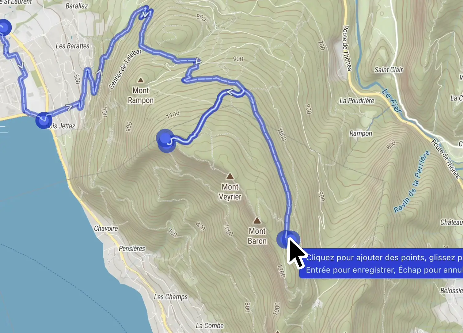
The workflow, on screen
The capabilities you will lean on every week, shown at work in the editor.
Works with the tools you already use









Challenges we solve
Train and race on routes that fit the terrain, not the road network.
Routes that respect your sport
Stop forcing trail runs through road-planner detours. Activity-aware routing follows the terrain under your feet, across trail, ultra, gravel, road, and ski touring.
Recon the course before you travel
Racing a course you have never seen means guessing. Import the race GPX and study every climb, surface change, and weather window before you toe the line.
From plan to watch in one export
No more juggling three apps to get a route onto your wrist. Export any itinerary as a GPX that Garmin, Suunto, and Strava import natively.
Map Studio
Every climb, surface, and weather window, read before you go
Draw the line and Map Studio reads it back: elevation profile, surface breakdown, and the weather window on every segment, ready to export as a GPX for your watch.
- Elevation profile and gradient on every segment
- Surface breakdown from trail to tarmac
- The weather window before you commit
The toolkit
One workspace, nine sports, no lock-in
Structure the whole course in one place, switch sport and watch the routing retune, then take it out as a GPX or a branded flythrough.
Itinerary builder
Define segments, aid stations, checkpoints, waypoints, and route variants, all organized in a single workspace.
Nine outdoor activities
Trail, road, gravel, hiking, ski touring, and more. Routing, surface, and pace retune to the sport you pick.
GPX and KML, no lock-in
Import a file to recon a course, export any itinerary native to Garmin, Suunto, and Strava.
Export as video
Render a branded flythrough of the finished course for race briefings and social.
Course craft
The small moves that make a course real
A course is not one long line. Restructure segments, group them for the people reading the map, read the grade of the terrain, and publish only when it is ready.
Merge, split, insert
Combine two segments, cut one in two, or drop a new segment between two others, without redrawing the course.
Segments grouped into one leg
Group a run of segments so readers see a single clean leg on the map and the elevation profile.
SAC and bike difficulty grades
Read SAC hiking grades from T1 to T6 and mountain bike technical grades on every segment of the line.
Draft now, publish when ready
Keep editing in a private draft. Athletes, viewers, and embedded maps only ever see the published version.
Plan in Mountaya, train on Strava
Build the route here with terrain, weather, and the elevation profile, then export a GPX that Strava imports natively.
 How Mountaya works with Strava
Why outdoor teams switch to Mountaya

- Route you onto roads and highways
- Weather and terrain live in three other tabs
- Every route redrawn from scratch
- Reshaping a route means dragging every waypoint by hand
- Sharing progress means emailing GPX files back and forth
- Exporting to your watch means juggling apps
- Activity-aware routing that follows the trail under your feet
- Weather, terrain, and snow on the same map
- Set a brief, get matching routes in seconds
- An AI co-pilot edits the map from a prompt while you refine it
- Real-time collaboration: your whole team edits one map together
- One GPX that Garmin, Suunto, and Strava read natively
Use case
How Campus Coach empowers 600,000 runners with instant outdoor intelligence from Mountaya, for greater training impact.

Mountaya's data intelligence lets us push personalization to a new level. We now fine-tune training plans to each athlete profile, from road to trail, with a precise command of distance and elevation demands.
Jonathan Levy


Pricing
Pricing built around how you map
Built for pro and ultra runners, cyclists, and mountain guides mapping their own routes.
125€/year
VAT included
Map Studio is free to use, with limited features and a cap on saved itineraries. Pro lifts every limit. Start free
Frequently asked questions
Yes. The Free plan includes the itinerary editor, with a cap on itineraries and segments. Pro lifts those limits and adds terrain and weather overlays, professional elevation profiles, and video export.
Pro is 12.50€ per month or 125€ per year. It lifts the Free plan's limits to unlimited itineraries, and adds terrain and weather overlays, professional elevation profiles, and video export.
Yes. Export to GPX from any route. Strava and Garmin import it natively.